 Lyman Mill Complex
Lyman Pond Complex-Historical information*
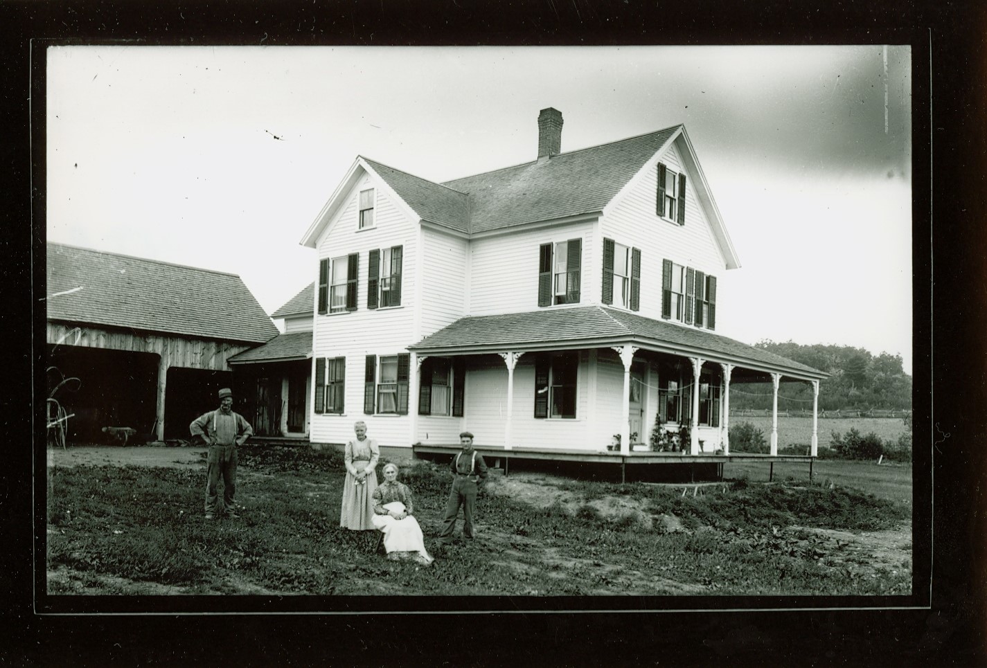
Industrial development of the water privilege where the current Lyman Dam is located began when Ichabod Strong (1711-1798) dammed the Manhan River and established a sawmill there in the early 1730s. Shortly thereafter, Strong added a gristmill at the site and throughout the eighteenth century the complex was known as Strong’s Mills. Strong was an early settler of Southampton and became a prosperous landowner and businessman. His saw and grist mills were important for processing lumber and grain products that supported the local agrarian economy during the early settlement of the town. He later also developed a potash works and in the later 1760s built a large Georgian-style home for his family, which included three sons, north of the mill complex at what is now 271 College Highway.
The 1794 (Barrett) plan of Southampton depicts a sawmill and a gristmill (separate buildings) on the east side of the Manhan River just north of the bridge at College Highway and a fulling mill not far upstream on Red Brook. The 1830 (Dwight) map of Southampton also depicts a sawmill and a gristmill in separate buildings at the same location on the Manhan River below Lyman Pond, although the fulling mill was no longer present.
After his death in 1798, Strong’s eldest son, John (1769-1848), inherited the mills. Another son, Phineas Sr. (1770-1855), also built and operated a gristmill, although it is unclear if that mill was at the same site as the elder Strong’s gristmill. In 1840, after the completion of Hampshire and Hampden Canal, Delano Bartlett purchased the house and converted it into the Lockville Hotel to serve travelers on the Canal. Phineas Strong Sr. purchased land east of the mill complex and in 1833 erected the house at 7 Moose Brook Road.
The Hampshire and Hampden Canal (later known as the New Haven and Northampton Canal) was completed in 1835 to provide transportation of the agricultural products from central Massachusetts and Connecticut to the port of New Haven on Long Island Sound. In Southampton the canal ran parallel to the Manhan River southeast of the Strong mill complex before crossing the Manhan River approximately 200 ft. downstream. Three of Southampton’s four locks on the canal were near Lyman Pond. The concentration of locks in the area was a notable feature of the canal and resulted in the village taking on the name of Lockville. The canal sparked a brief period of development along the Manhan River where a dozen sawmills produced compious quantities of lumber for shipment to neighboring towns. However, like many other canals that were developed in the 1820s and 1830s following the success of the Eerie Canal in New York, the New Haven and Northampton Canal proved to be a short-lived enterprise that never fulfilled the promises of its developers and was put out of business by the advent of railroads. The canal system was abandoned in 1847, and its route later was incorporated into the New Haven & Northampton Railroad, which was completed through Southampton by 1856.
Remnants of the canal that survive within the Lockville Historic District consist of Canal Lock 22, which is along the railroad embankment immediately south of the College Highway (Route 10) Bridge and a portion of the canal prism south of Lyman Mill. Other properties that are associated with the canal are the Lockville Hotel and the New Haven and North Hampton Canal Storehouse, a large vernacular barn-like building at 100 Brickyard Road that was probablly used to store goods awaiting transportation and was later converted to a residence.
In 1847, coinciding with the abandonment of the New Haven and Northampton Canal, Noah Lyman Strong (1807-1896), the son of Phineas Sr. and Eunice (nee Lyman, 1779-1859) Strong, purchased half interest in the Strong mill privilege . The following year, Noah Strong was elected to represent Southampton in the state legislature, serving one term before he was elected State Senator for Hampshire County. According to the 1850 federal census of manufacturers, Noah Strong’s sawmill and gristmill was capitalized at $1,500 and employed three men who each earned $22 a month. The sawmill produced 1,750 lathes valued at $3,750 and custom woodwork valued at $240. The gristmill produced 7,000 bushels of meal valued at $4,568.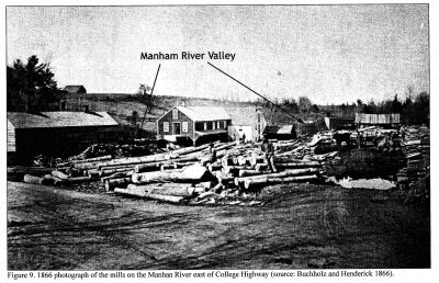
In 1858, Noah Lyman Strong acquired full ownership of the Lyman Mill Complex and associated property from his mother and brother, Eunice and Phineas, Jr., who presumably inherited Phineas Sr.’s half-share of the property upon his death in 1855. The deed describes the property at the time consisting of “a mill yard, dam and waterpower, and a mill heretofore used for a saw mill, shingle mill, and grist mill, so connected together that the same cannot be divided without damage to the owners”. The milling operations described were below Lyman Pond on the southeast side of the Manhan River northeast of College Highway. In 1860, Noah Strong sold the mill property at College Highway to Orren Root and John Holle, marking the first time since its initial development that the property was owned outside of the Strong family. The 1860 census indicates that Noah Strong had by then moved his family to Westfield, where he owned a farm and operated tenements.
An 1860 map of Southampton shows the mill impoundment (Lyman Pond) extending westward from the dam under a bridge on Mountain Brook Road (now College Highway) to the confluence of the Manhan River and Red Brook (then called Mountain Brook). The 1860 federal manufacturers census provides details abut the saw and grist milling operations that were conducted at the privilege. Henry Sheldon was listed as the operator of a “flouring mill” that was capitalized at $3,000 and employed one man earning $30 a month. At that time, the mill produced 10,000 bushels each of corn and rye meal with an annual total value of $22,000. William Miller operated the sawmill for six months of the year with $1,000 capital and one employee earning $20 a month. The sawmill produced 5,000 boards and 5,000 planks of chestnut oak work $990 each. The 1860 federal population census and the 1865 Massachusetts state census for Southampton lists Henry Sheldon as a farmer and William Miller as a manufacurer and sawyer, respectively. An 1866 photographs depicts the sawmill and gristmill as several one-story buildings bordering the river to the north and the lumber yard on the south side near the railroad tracks. By the late 1860s, the “mills” reportedly consisted of a a gristmill, a sawmill, and a shingle mill on the first floor and a whip shop with several plating machines operated by Samuel Quigley on the second floor.
In 1864 John Holle sold his holdings at the mill complex to Charles, Warren, and Horace Stimpson (also appears Stimson), who operated the mills under the name Stimpson & Co. In 1870 Elijah Lyon (1823-1917) and Albert S. Atkins purchased the property from Stimpson & Co. Deeds from this time period describe the property as a one-and-one-quarter acre triangular piece of land, containing the mill, mill privilege, and mill yard, known as Strong’s Mill.
The 1870 federal population census lists Eligah Lyon as a farmer, with his son, George Horace Lyon (1849-1921) as a miller and George Searle listed in the household as a “Mill Hand”. An 1873 map of Southampton depicts the gristmill and sawmill as operated by Atkins, Lyon & Company on the southeast side of the river. That same year, Elijah and George Lyon purchased Atkins’ share of the property, becoming sole owners of the mill complex. Around that time, the complex was destroyed after heavy flooding and a fire. Instead of rebuilding the mill, the Lyons replaced it with a three-story steam sawmill and gristmill (the current Lyman Mill building) that Joseph Sheldon had built between 1856 and 1860 at the intersection of College Highway and Moose Brook Road. Sheldon’s milling operations at the building had ceased during or shortly after the Civil War and it served for a brief time a tenement house know as the “Beehive:.
After the move, the Lyons added a one-story addition to the west side of the building, removed one of the interior floors, and fitted it for water powered production by adding a water wheel. The Lyons reportedly employed four men at the mill, which housed a gristmill with one run of stones that did both custom and merchant work, “grinding about 40,000 bushels of grain per year,” and a sawmill equipped with a circular saw, shingle machine, and planer, producing “about 500,000 board feet of lumber and 150,000 shingles per year”. There is no information about the Lyons mill operations in the 1880 federal census, although other sawmills on the Manhan River were identified.
An 1890 photograph of the mill site depicts the dam, a portion of the mill building on the south side of the river, and the mill pond extending from the mill nearly to the steep embankment of College Highway. 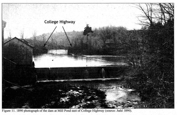
Lyman Mill Complex Dam 1890 Herbert Bartlett Lyman (1863-1945), son of Rufus Lyman and Sarah Bartlett of Southampton moved back to the town from Holyoke in 1893, and established the Lyman Sheet Metal Works on the north bank of the Manhan River mill pond, opposite the Lyon’s gristmill and sawmill, to produce stove pipe elbows and related products in 1894. Herbert Lyman was the second cousin twice removed from Noah Lyman Strong, of the Strong Family that initially developed the mill privilege in Lockville, and it is likely that locals began referring to the mill privileges and buildings by the Lyman name around that time. The Lyman family owned the former John Strong Jr. House/Lockville Hotel since about 1870, and Herbert resided there first as a child then from the time he returned to Southampton as an adult until his death.
Elijah Lyon sold the remainder of his Southampton properties to his sons, George H. and William Stephen (1847-1938) Lyon, in 1897. That same year George H. transferred one-half share of the “old mill site” to William, making them partners in the mill. Prior to operating the grain and sawmill in Southampton, William was a builder and brick mason. The 1900 federal population census lists William Lyon as a “Miller” and the 1910 census George H. Lyon as a “Retail Merchant in Grain.” A 1900 photograph depicts the two-and-a-half story shed attached to the main mill building. During the early 1900s, however, the City of Holyoke began drawing from the Manhan River to supplement its water supply and the resullting lower levels forced the Lyons to close the mill. In 1915, Herbert B. Lyman purchased the Lyon family’s water rights, mill, dam, and associated property opposite his sheet metal works.
A 1915 NYNHH Railroad valuation map shows the complex in the general configuation that it would retain into the twenty-first century. The 1920 federal population census lists Herbert B. Lyman as a “Manufacturer in Sheet Metal” and Herbert H. Lyman as a “Sawyer in Lumber Mill,”indicating that the sawmill operation may have resumed by that time. In a deed dated January 14, 1930, Herbert B. Lyman transferred ownership of two parcels on either side of the Manhan River, with the second parcel known as the “George H. Lyon Grist MIll and Lot,” to his company H. B. Lyman Company.
In the Mid-1930s, possibly during the Massachusetts Great Flood of March 1936, the existing stone dam at the Lyman privilege was destroyed by a flood. In 1938, the H. B. Lyman Company hired the construction firm of Caughey & Pratt of Antrim, New Hampshire, to design and contruct the current concrete dam. The earlier dam was likely a stone masonry gravity dam that was built in the nineteenth century at the location of an even earlier dam. The 1939 dam is an example of an “Ambursen Type,” a buttressed concrete gravity dam that was developed by civil engineer Nils F. Ambursen, founder of the Ambursen Hydraulic Construction Company based in Boston, MA. The design was copied quite often during this period, despite numerous patents obtained by Ambursen, due to its strength, which was derived in large part from its inclined upstream deck, which bore much of the upstream water weight, and reinforced concrete downstream buttresses.
In a deed dated February 3, 1958, the H. B. Lyman Company transferred two parcels of land east of College Highway on the Manhan River to Jennie Lyman Stone. The 1958 deed (and following deeds) indicates that both parcels were conveyed together with the “existing dam and all rights therein and thereto which said dam runs northwesterly and southeasterly across said Manhan River and has its norhwesterly abutment on the first parcel above described and its southearerly abutment on the second parcel above described.” On November 21, 1974, Jennie E. Lyman Stone conveyed an undivided one-third interest in the two parcels to Richard S. and Miriam S. Howland, as tenants, for no monetary consideration. On February 6, 1989, Richard S. and Miriam S. Howland transferred both parcels (along with other non-contiguous parcels) to Richard S. Howland for $1.
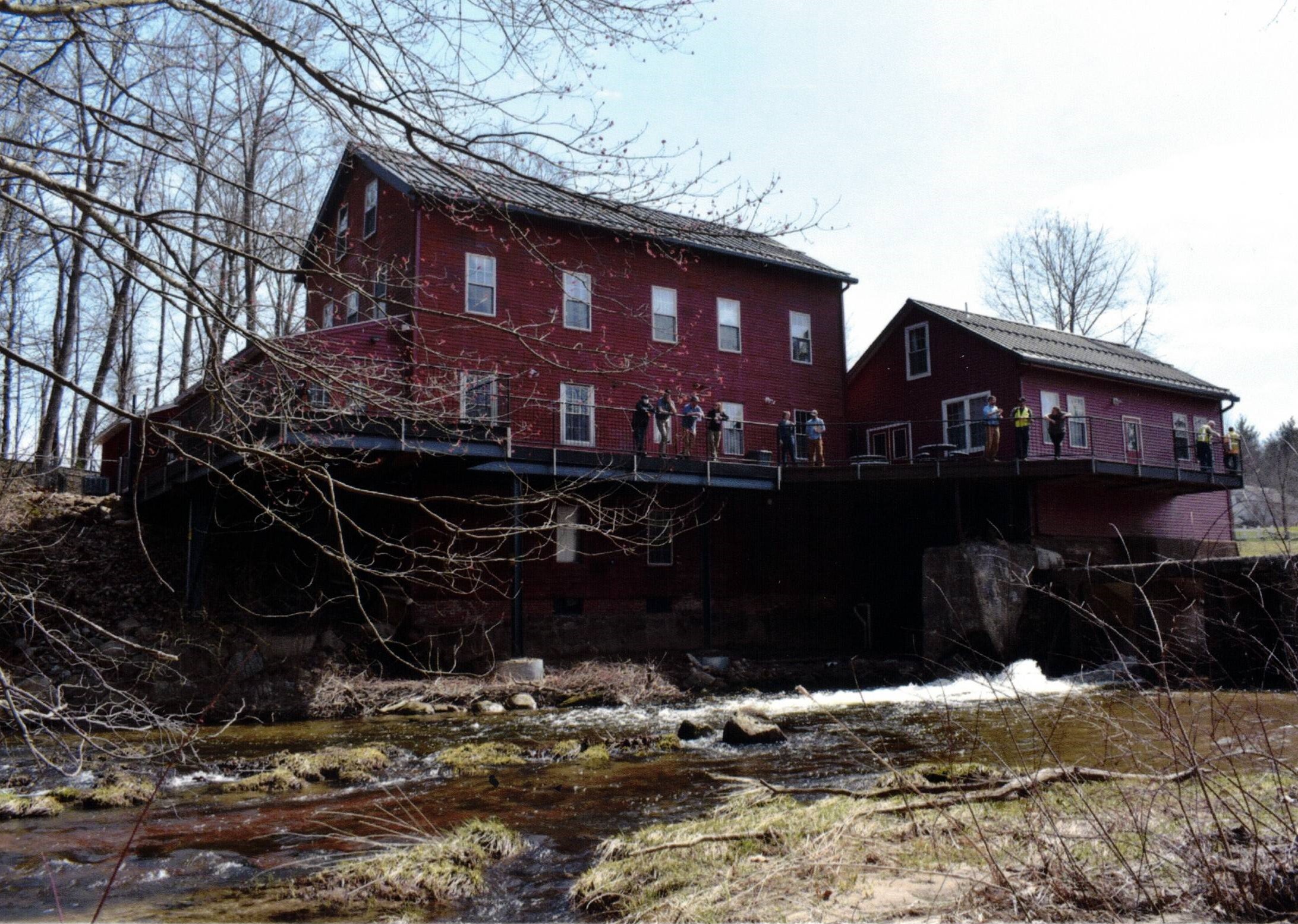
The mill buildings were used for storage by the Lyman Sheet Metal Works until the 1990s. On December 26, 1997, Richard S. Howland sold the mill building, dam, and adjoining property to Glenn R. West for $4,000. The building, locally called the “old grist on the Manhan,” was converted into an ice cream and sandwish shop in use today as “Sheldon’s Ice Cream” at 285 College Highway.
*For complete transcript and bibliographical information please see “Historic and photographic documentation Lyman Mill Complex” Barcode 37387091104164 Call No.: HISTORICAL 974.44 Lyman LOCAL
Return to the Edwards Public Library website.